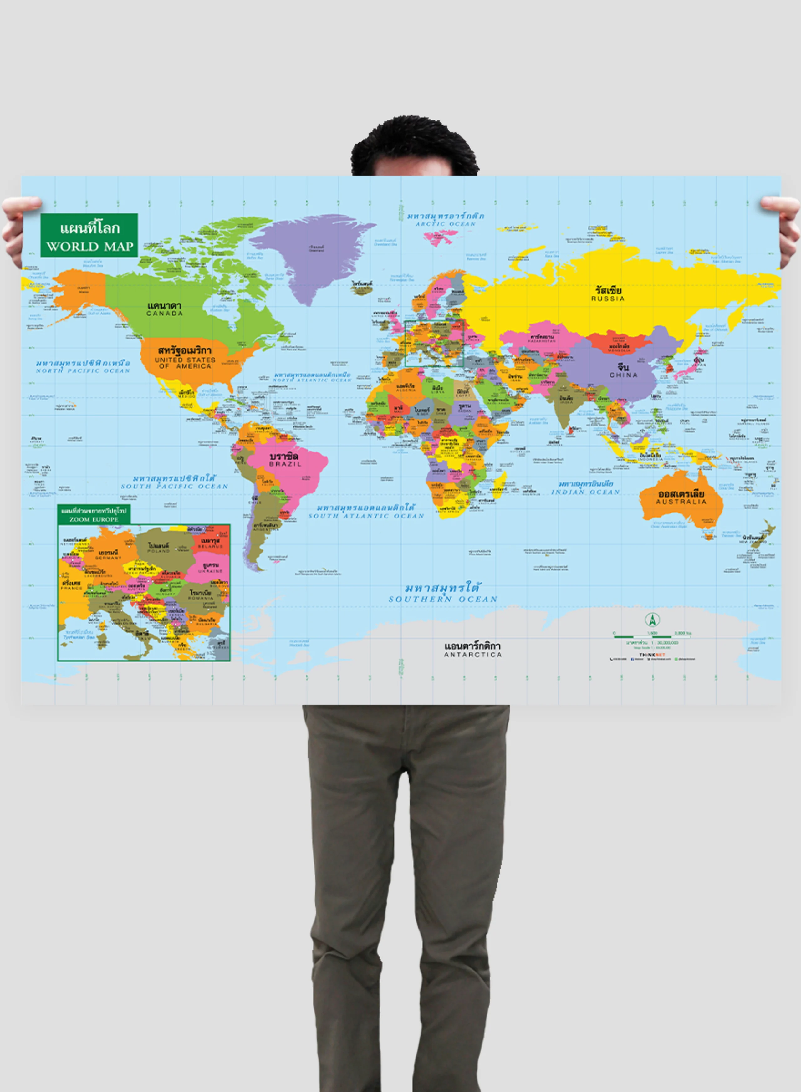
• English

THiNKNET Co., Ltd. (Head Office)
323 United Center Building, 6th Floor, Room 601,
Silom Road, Silom, Bangrak, Bangkok 10500

www.thinknet.co.th0 2480 9990sales@thinknetdesign.studio@thinknetdesign
All Products

EDUCATION

Science

Mathematics

Language and Communication

Social Studies

Arts

General Knowledge

Accessories

BUSINESS MAPS

Bangkok

Thailand

Book

Folded

DECOR

Map

View

Nature

Science

Feng Shui

Abstract

Digital Art

Artist Collection

Copyright © 2025 THiNKNET Co., Ltd. All Rights Reserved.

Terms of Use | Disclaimer | Cookie Policy
  1. HOME
    • EDUCATION
  2. Social Studies
  3. Political Map of the World's Countries
ED_Sheet_Paper-01

Political Map of the World's Countries

Maps & Educational Materials
THB 449 - 4,999

Design:
Product Details
Political map of the world.

• Shows the governmental boundaries of 193 countries, divided by colors.
• Shows country names, capital cities, important cities, gulfs, oceans, and islands.
• Shows territories of countries around the world.
• Additional Europe inset map.
• Bilingual: Thai-English.
• 2022 updated.
• Size (M) 100x69 cm has a scale of 1: 40,000,000, size (XL) 138x100 cm has a scale of 1: 29,000,000.
• Suitable for senior high school students age 15-17 years old.

PRODUCTS YOU MAY BE INTERESTED IN

Political Map of South Asia

Political Map of South Asia

THB 449 - 4,999

Political World Map: Behrmann Projection

Political World Map: Behrmann Projection

THB 449 - 4,999

Political World Map: Goode Homolosine Projection

Political World Map: Goode Homolosine Projection

THB 449 - 4,999

Periodic Table of The Elements: Light Grey

Periodic Table of The Elements: Light Grey

THB 449 - 4,999

The Solar System

The Solar System

THB 449 - 4,999