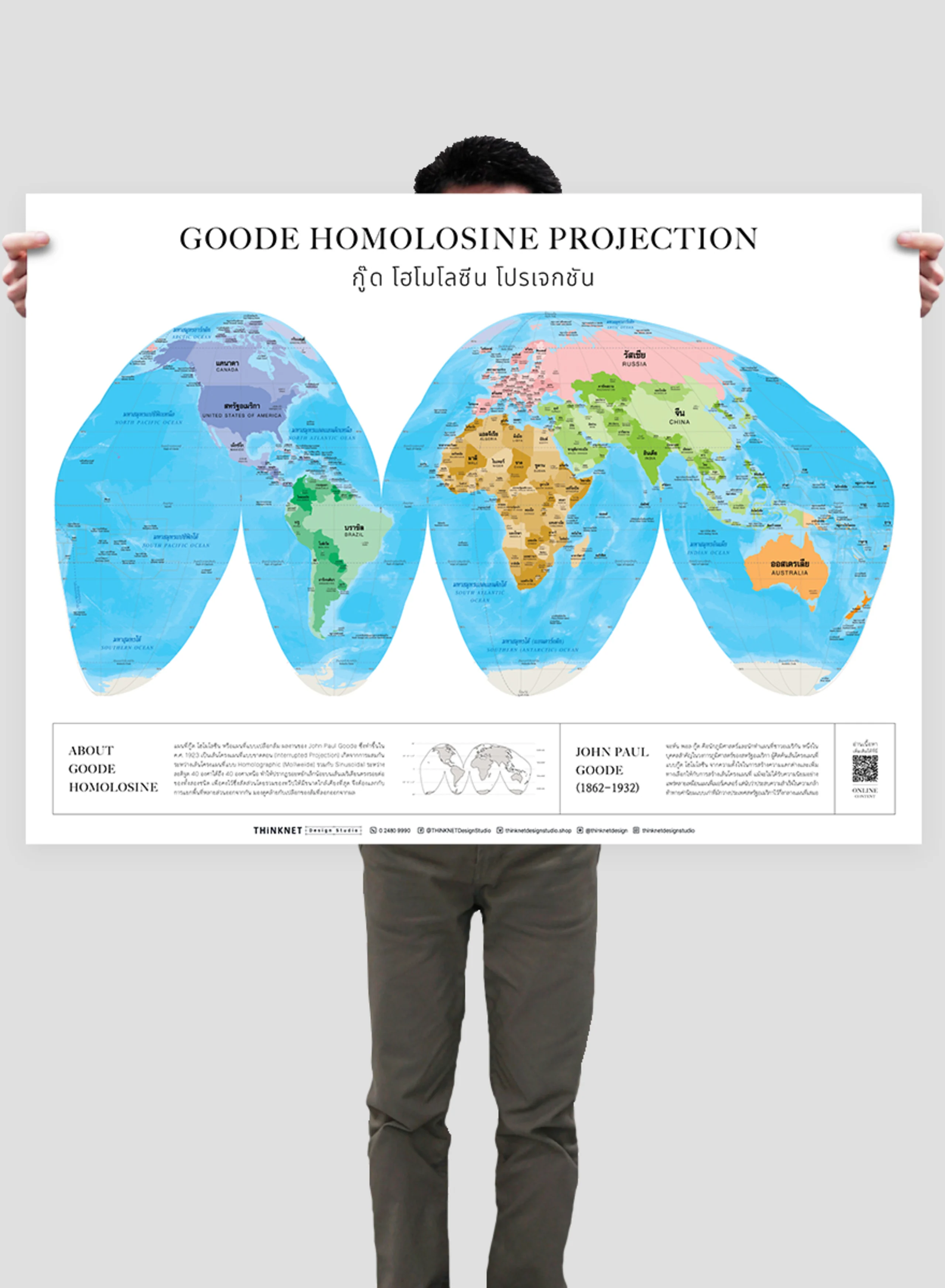
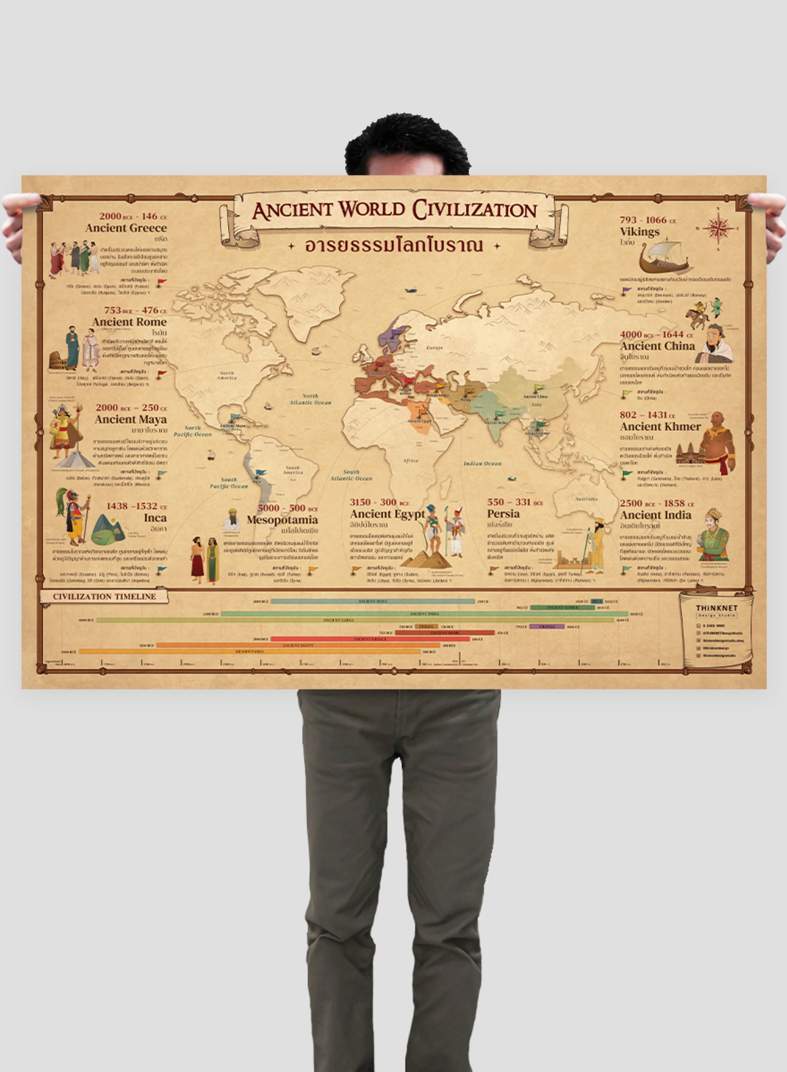
• English

THiNKNET Co., Ltd. (Head Office)
323 United Center Building, 6th Floor, Room 601,
Silom Road, Silom, Bangrak, Bangkok 10500

www.thinknet.co.th0 2480 9990sales@thinknetdesign.studio@thinknetdesign
All Products

EDUCATION

Science

Mathematics

Language and Communication

Social Studies

Arts

General Knowledge

Accessories

BUSINESS MAPS

Bangkok

Thailand

Book

Folded

DECOR

Map

View

Nature

Science

Feng Shui

Abstract

Digital Art

Artist Collection

Copyright © 2025 THiNKNET Co., Ltd. All Rights Reserved.

Terms of Use | Disclaimer | Cookie Policy
  1. HOME
    • EDUCATION
  2. Social Studies
  3. Political Map of North and South America
ED_Sheet_Paper-1

Political Map of North and South America

Maps & Educational Materials
THB 449 - 4,999

Design:
Product Details
Political map of North and South America.

• Shows the overview of North and South America.
• Shows 22 countries in North America: Canada, the United States, Cuba, Panama, Mexico, Barbados, etc, and 13 countries in South America: Brazil, Ecuador, Argentina, Chile, Bolivia, etc.
• Shows the governmental boundaries of each country, territory borders with neighboring countries, islands, archipelagos, gulfs, seas, and important oceans.
• Shows capital cities and overseas territories.
• Bilingual: Thai-English.
• 2023 updated.
• Size (M) 69x100 cm has a scale of 1:23,500,000 , size (XL) 100x138 cm has a scale of 1:16,800,000.
• Suitable for junior high school students age 12-14 years old.

PRODUCTS YOU MAY BE INTERESTED IN

Political World Map: Peirce Quincuncial Projection

Political World Map: Peirce Quincuncial Projection

THB 449 - 4,999

Physical Map of Australia and Oceania

Physical Map of Australia and Oceania

THB 449 - 4,999

Political Map of the World's Continents

Political Map of the World's Continents

THB 449 - 4,999

Political World Map: Mollweide Projection

Political World Map: Mollweide Projection

THB 449 - 4,999

Color Theory: White

Color Theory: White

THB 449 - 4,999